Guide · Comparisons
The best live tracking for adventures (2026)
By AdventureLive · Updated
What is the best live tracking for an adventure?
There is no single best. The right tool depends on what you carry, where you go and what your family wants to see. This guide compares ten options fairly, says what each does best, and ends with a pick by need.
We make AdventureLive, so we say so up front. We have read each product's own pages for this comparison and link them under Sources. Where a page does not say something, we write "not stated on its site" and do not guess. Prices are at the time of writing (2026) and change, so check them before you buy.
How do the ten options compare?
The table is the short version. The sections after it add detail.
| What it needs | Works without phone signal? | Cost to the adventurer | What followers see | Weather where you are? | Alerts to family? | Best for | |
|---|---|---|---|---|---|---|---|
| AdventureLive | An inReach (via MapShare), a SPOT (via its shared page) or Garmin LiveTrack | Yes with an inReach or SPOT. LiveTrack needs the phone to have signal | Free, thanks to ProLend. Your tracker and its plan are your own cost | 3D satellite map, planned route, line travelled, dot, check-ins, progress. No app or account needed | Yes, now and for 48 hours, with safety alerts | Yes: up to 5 home contacts get HELP emails. Rescue and SOS are run by Garmin Response or SPOT's GEOS centre | Families following an inReach or SPOT trip with the weather |
| Garmin MapShare (Garmin Explore) | An inReach and an active satellite subscription | Yes, over the Iridium network | MapShare is described as free by forum users; the inReach needs a subscription; location requests count toward your plan | Track points, your messages, planned routes, waypoint notes; followers can message you | Not stated on its site | Not stated on the pages we read | Following an inReach with two-way messages |
| SPOT shared page (Shared View) | A SPOT and its account | Yes, SPOT is a satellite device | Not stated on the page we read | Your messaging and tracking activity | Not stated on its site | Not stated on the page we read | Simple sharing of a SPOT's breadcrumb |
| SpotWalla | A SPOT, a Garmin or ZOLEO satellite device, or a phone tracking app; SPOT is polled | Yes with a satellite device | A membership is needed to create devices and share trips; price not stated on the page we read | Trips that are public or private, with or without a password; Location Pages show several users' last known positions on one map | Not mentioned on its site | Not mentioned on its site | Sharing a SPOT's trips, or a group or event on one map |
| Polarsteps | A phone with the app | Records offline, syncs when back online | Tracking listed as free | A trip map and journal for people you allow | Not stated on its site | Not stated on its site | Travel journals and Travel Books |
| FindPenguins | A phone with the app (the App Store listing names iPhone and iPad) | Tracker runs offline; uploads when back online | Listed as free | A journal with photos, stories and route | Not stated on its site | Not stated on its site | Travel blogs and hardcover books |
| YB Tracking | A YB3 tracker, usually rented for an event | Yes, over Iridium | YB3 from £449 + tax, line rental £18 a month, credits extra; rentals by quote | Race viewer, leaderboard, replay | Not stated on its site | Red Button Alert on the YB3; no family emails stated | Ocean races, rallies, adventure races |
| Garmin LiveTrack on its own | A Garmin watch or bike computer paired by Bluetooth to a phone running Garmin Connect | No. It needs the phone connection | Not stated in the manual we read | A live page for the contacts you add | Not stated in the manual | Not stated in the manual | Day runs and rides with phone signal |
| Strava Beacon | The Strava phone app, recording an activity | No. It needs phone data | Free in the phone app; connected devices need a subscription | Your live location, for up to three people | Not stated on its site | Not stated on the pages we read | A short outing with signal and a few contacts |
| ZOLEO location share | A ZOLEO device and an active plan | Yes, it is a satellite messenger | Location Share+ is an optional monthly add-on | Check-ins and breadcrumb trails in the app; ZOLEO Track is a web map with share links | In the ZOLEO app, powered by Xweather, per its home page | Check-ins to a Safety Circle, per its home page | ZOLEO owners who want a web link for family |
AdventureLive: what does it do best?
AdventureLive turns an inReach, SPOT or LiveTrack feed into one trip page that family can open in any browser. It is free, thanks to ProLend, and it has no phone app.
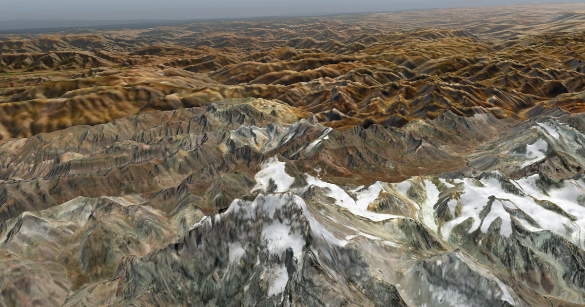
You plan a trip on the web with a name, a start and legs. A leg can have a GPX route, or no route at all, as on an ocean row or a swim. Followers see a 3D satellite map, the planned route, the line you have actually travelled and your dot. They see "Seen 22 min ago, via inReach", your check-in messages, and the weather where you are now and for the next 48 hours. Safety alerts flag strong wind, gales, severe cold, heat, heavy rain and thunderstorms, where you are and on the route ahead.
You can link several trackers. The freshest position wins, so there is one dot. You choose who can see the trip: findable, link only, or people you approve. Up to five home contacts get an email if the device sends a HELP message. Rescue itself, and any SOS, is the job of Garmin Response or SPOT's GEOS centre, not ours.
What it does not do: it has no journal or photo feed, and your dot is only as fresh as your tracker's own interval. It reads an inReach at most every 4 minutes and a SPOT at most every 2½ minutes, and only while a trip is live. See how to link a tracker and going live.
Garmin MapShare: what does it do best?
MapShare is Garmin's own sharing page for the inReach, and it is the most direct way to show an inReach's track. Garmin says track points populate your MapShare page as you move, that messages you send appear there, and that you can add waypoints with notes. It also says followers can message you if they have your link, plus the password if you set one.
On cost, Garmin's pages we read say an active satellite subscription is required for live tracking and messaging. Forum users describe MapShare itself as free. Garmin's South Africa page says location requests count toward your plan. We have not found a published weather feature on MapShare. Read the full comparison in AdventureLive vs Garmin MapShare.
The SPOT shared page: what does it do best?
SPOT's Shared View is the official way to share a SPOT's tracking. Globalstar's support page says you create it from the mapping page of your SPOT account, then send the link to contacts. It shares your messaging and tracking activity. It works with a device that is already on your belt. The page we read does not state a cost, so check your plan. See AdventureLive vs the SPOT shared page.
SpotWalla: what does it do best?
SpotWalla is the long-standing add-on for SPOT owners who want more control than the SPOT page gives. Its site calls it an online personal location management system. It supports satellite trackers from SPOT, Garmin and ZOLEO, and phone tracking apps. Trips can be public or private, password protected or open, and embedded in a blog or forum post.
Its strength for groups is Location Pages, which show the last known position of several users on one map, and Retrospectives, which show several trips together. That is useful for an event or a team. The site says a membership is needed to create devices and share trips, and the pricing is on a page we did not read. Its help pages say it polls SPOT for new locations, and that each SPOT needs its own XML feed. We found no weather or alerts-to-contacts feature on its site. Compare it with the SPOT shared page and read our SPOT shared page alternatives. See AdventureLive vs SpotWalla.
Polarsteps: what does it do best?
Polarsteps is a travel journal that tracks your route on your phone. Its site says tracking is free, that it works offline and that data syncs when you reconnect. It lets you choose who sees each trip, and it sells Travel Books. If the goal is a keepsake of a long trip, it is very good at that. Because it syncs after you reconnect, it is not live while you are off the grid. See AdventureLive vs Polarsteps.
FindPenguins: what does it do best?
FindPenguins is a travel journal and route tracker. Its App Store listing says the tracker is battery-friendly and works offline, lets you add photos, videos and stories, and can turn memories into a hardcover book. It also lists 3D flyover videos of your route. It suits people who want to blog a trip. See AdventureLive vs FindPenguins.
YB Tracking: what does it do best?
YB Tracking is the standard for ocean races, and it is built for fleets. Its site lists the Rolex Fastnet, Sydney Hobart and Vendée Globe among its customers, plus adventure races and rallies. Its race viewer has a live leaderboard with handicaps applied, 3D maps and replay. The YB3 is a satellite tracker that sends over Iridium. See AdventureLive vs YB Tracking.
Garmin LiveTrack on its own: what does it do best?
LiveTrack is easy if you already wear a Garmin. You set it up in Garmin Connect and add contacts, and it shares a live page while you move. The manuals we read say it needs a Bluetooth link to a phone running Garmin Connect, so it works where your phone has signal. One manual says sharing stays on for 24 hours once enabled. It is a good fit for a run or ride near coverage. AdventureLive can also read a LiveTrack feed; see Garmin LiveTrack in AdventureLive and AdventureLive vs Garmin LiveTrack.
Strava Beacon: what does it do best?
Beacon is the simplest safety share for a short outing. Strava says any athlete can use it free when recording in the mobile app, and you can nominate up to three people. Using it through a connected device still needs a Strava subscription. A guide we read says it relies on phone data, so contacts see the last position that got through if you lose signal. See AdventureLive vs Strava Beacon.
ZOLEO location share: what does it do best?
ZOLEO is a satellite messenger that works with your phone. Its support pages describe Location Share+ as an optional monthly add-on with up to five check-in contacts who use the ZOLEO app. A separate web map, ZOLEO Track, shows check-ins and breadcrumb trails and can be shared by link. If you already own a ZOLEO, that link is the natural first step. Its home page says the app shows weather forecasts, powered by Xweather. See AdventureLive vs ZOLEO.
Which should you choose?
Pick by what you carry and what your family wants.
- If you carry an inReach or SPOT and want family to follow with the weather there: AdventureLive.
- If you carry an inReach and mostly want two-way messages with followers: Garmin MapShare, with AdventureLive alongside if you want the weather and HELP emails.
- If you are in an ocean race or a rally with an official tracker: the race's YB tracker, and AdventureLive alongside for family.
- If you run a group or an event and want several devices on one map: SpotWalla (its Location Pages), and AdventureLive for each person's family and the weather.
- If you want a journal and a book: Polarsteps or FindPenguins, and a satellite tracker for live following.
- If you only have a Garmin watch or a phone and plenty of signal: LiveTrack or Strava Beacon.
- If you own a ZOLEO: ZOLEO Track for the web link.
These are not exclusive. Many trips use two tools. To start, Plan your trip. For more, read how to let family track you live and inReach vs SPOT vs ZOLEO.
The forecast on any page is a guide, not a guarantee. Check local forecasts and warnings before you set out.
All guides in this topic
 Comparison · Comparisons5 Best YB Tracking Alternatives in 2026Five YB Tracking alternatives for 2026: Garmin MapShare, AdventureLive, SPOT Shared Views, SpotWalla and ZOLEO, compared on cost, signal and weather.
 Comparison · Comparisons6 Best FindPenguins Alternatives in 2026Six FindPenguins alternatives for 2026: Polarsteps, AdventureLive, MapShare, SpotWalla, Wanderlog and SPOT, compared on signal, cost and weather.
 Comparison · Comparisons6 Best Life360 Alternatives for Hiking and Expeditions in 2026Life360 needs a connection to update. Six options for hikes and expeditions: inReach, AdventureLive, SPOT, ZOLEO, LiveTrack and Google Maps, compared.
 Comparison · Comparisons6 Best SpotWalla Alternatives in 2026Six SpotWalla alternatives for 2026: SPOT Shared Views, AdventureLive, MapShare, ZOLEO, Polarsteps and YB Tracking, compared on cost and weather.
 Comparison · Comparisons7 Best Garmin MapShare Alternatives in 2026 (Free & Paid)Seven alternatives to Garmin MapShare for sharing your trip in 2026: SPOT, AdventureLive, SpotWalla, ZOLEO and more, compared on cost, signal and weather.
 Comparison · Comparisons7 Best Polarsteps Alternatives in 2026 (Free & Paid)Seven Polarsteps alternatives for 2026: FindPenguins, AdventureLive, MapShare, SPOT, SpotWalla and more, with signal, cost, followers and weather compared.
 Comparison · Comparisons7 Best Strava Beacon Alternatives in 2026 (Free & Paid)Seven ways to let family see where you are beyond Strava Beacon: inReach, AdventureLive, SPOT, ZOLEO, LiveTrack, Google Maps and Polarsteps, compared.
 Comparison · ComparisonsAdventureLive vs Bivy Stick tracking: what each doesBivy Stick has its own link; AdventureLive can't read it. What each does, from their own pages, and how to use both by carrying an inReach or SPOT.
 Comparison · ComparisonsAdventureLive vs Garmin LiveTrack: which should you use?Garmin LiveTrack shares a live page from your Garmin and phone. AdventureLive reads it and adds a 3D map, weather and HELP emails. From Garmin's manuals.
 Comparison · ComparisonsAdventureLive vs Garmin MapShare: which should you use?Garmin MapShare and AdventureLive both show an inReach to family. Here is what each does, what it costs and when to use both, from their own pages.
 Comparison · ComparisonsAdventureLive vs Life360 for hikes and expeditionsLife360 is a family location app for phones. AdventureLive reads an inReach, SPOT or LiveTrack on hikes and expeditions. What each is for and when to pick.
 Comparison · ComparisonsAdventureLive vs Polarsteps: live tracking or travel journal?Polarsteps is a travel journal that tracks offline and syncs later. AdventureLive shows a satellite tracker live with the weather. They do different jobs.
 Comparison · ComparisonsAdventureLive vs PredictWind tracking for sailorsPredictWind has a free tracking page for boats; AdventureLive reads only inReach, SPOT and LiveTrack. What each shows family, and when to use both.
 Comparison · ComparisonsAdventureLive vs Somewear: what each does and doesn'tSomewear sells satellite hardware; AdventureLive reads only inReach, SPOT and LiveTrack. What Somewear's pages state and leave out, and how to use both.
 Comparison · ComparisonsAdventureLive vs SpotWalla: which should you use?SpotWalla shows SPOT, Garmin and ZOLEO tracks online. AdventureLive reads an inReach, SPOT or LiveTrack and adds weather and HELP emails. Compared fairly.
 Comparison · ComparisonsAdventureLive vs Strava Beacon: which should you use?Strava Beacon texts a live link from your phone. AdventureLive reads an inReach, SPOT or LiveTrack. What each needs and does, and when to use which.
 Comparison · ComparisonsAdventureLive vs the SPOT shared page: which to use?SPOT Shared View shows your tracking and messages to family. AdventureLive reads the same feed and adds weather and HELP emails. A fair comparison.
 Comparison · ComparisonsAdventureLive vs YB Tracking: race tracker or family page?YB Tracking is the standard for ocean races. AdventureLive is a free family page for your own inReach or SPOT. Use YB in the race, then both for home.
 Comparison · ComparisonsAdventureLive vs ZOLEO location sharing: which to use?ZOLEO has its own Location Share+ and ZOLEO Track web map. AdventureLive reads an inReach, SPOT or LiveTrack, not ZOLEO. A plain comparison.
Questions people ask
- What is the best way for family to follow my adventure live?
- If you carry an inReach or SPOT, a tracker page that your family can open in a browser is the simplest way. AdventureLive adds the weather where you are and HELP emails to home contacts. If you travel with a phone only, Polarsteps or FindPenguins suit a journal.
- Which live tracking works without phone signal?
- Satellite devices such as the inReach, SPOT, ZOLEO and YB3 send positions over satellite networks. Phone apps record offline and upload later, so followers do not see you live while you are out of signal.
- Is there free live tracking for adventurers?
- AdventureLive is free, thanks to ProLend, but you still need your own tracker and its plan. Polarsteps and FindPenguins list free tracking in their apps. Strava Beacon is free on the phone app.
- Can I use more than one tracking service on the same trip?
- Yes. A tracker page, a journal app and a race tracker do different jobs. Many people run a satellite tracker for family and a journal app for the memories.
- Does any of this replace emergency rescue?
- No. Rescue is run by the satellite device's own emergency service, such as Garmin Response or SPOT's GEOS centre. Tracking pages are for people at home to follow along.
Sources
- Garmin: Share your journey with inReach and MapShare
- Garmin: Your inReach device questions (South Africa)
- Globalstar: How do I share my tracking with other people? (SPOT Gen4)
- SpotWalla: home
- SpotWalla help: devices
- Polarsteps: Travel tracker
- Polarsteps support: Does Polarsteps work offline?
- FindPenguins on the App Store
- YB Tracking: home
- YB Tracking: YB3 handheld tracker
- YB Tracking: event rental
- Garmin manual: Turning on Live Event Sharing (LiveTrack)
- BikeRadar: Strava Beacon relaunch
- WhistleOut: Use Strava Beacon to share your live location
- ZOLEO Track overview (ZOLEO support)
- ZOLEO Location Share overview (ZOLEO support)
Related guides
Comparison · ComparisonsAdventureLive vs Garmin MapShare: which should you use?Garmin MapShare and AdventureLive both show an inReach to family. Here is what each does, what it costs and when to use both, from their own pages.Comparison · ComparisonsAdventureLive vs the SPOT shared page: which to use?SPOT Shared View shows your tracking and messages to family. AdventureLive reads the same feed and adds weather and HELP emails. A fair comparison.Comparison · ComparisonsAdventureLive vs Polarsteps: live tracking or travel journal?Polarsteps is a travel journal that tracks offline and syncs later. AdventureLive shows a satellite tracker live with the weather. They do different jobs.Comparison · ComparisonsAdventureLive vs YB Tracking: race tracker or family page?YB Tracking is the standard for ocean races. AdventureLive is a free family page for your own inReach or SPOT. Use YB in the race, then both for home.AdventureLive vs FindPenguins: journal app or live tracker?